
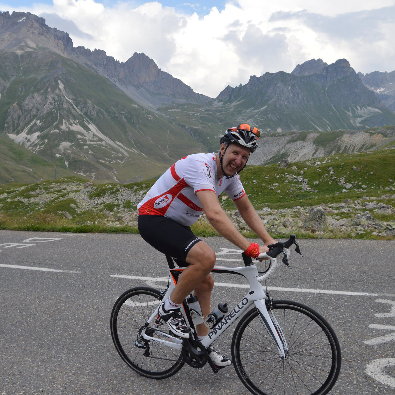
ROUTE DES GRANDES ALPES
The Route des Grandes Alpes stretches from the shores of beautiful Lake Geneva, the largest lake in Western Europe, to the bustling resort of Menton on the Côte d'Azur, crossing many of the highest, and most well-known alpine cols along the way.
£1,700, 7 NIGHTS
700KM, 17 COLS, AROUND 18,000 METRES OF CLIMBING
The road was constructed a hundred years ago, allowing easy access to isolated mountain villages for the first time, many of which have since become ski resorts. If you've been here skiing, you'll be amazed at how different it looks without its winter coat. The official route runs straight past the foot of the Cime de la Bonette (2802m), the second highest paved route in the Alps and the highest point ever reached by the Tour de France. We couldn't see how you could be so close and not give everyone the option to ride it, so we've included it, which makes this fully-supported cycling tour a little longer, a little more demanding, but also a little more interesting than the official route.


ARRIVAL DAY
We'll be at Geneva airport to meet you and then we'll take you to our hotel in Evian-les-Bains, on the banks of Lake Geneva, where there will be tools and track pumps available so you can assemble your bike. Later we'll get to know each other and discuss the trip in detail over dinner.
DAY 1 - LAKE GENEVA TO FLUMET - 124KM, CLIMBING 2,800 METRES
We climb gently as we ride away from the lake to join the D902, following the river Dranse along the winding Vallée Verte and past the Gorges du Pont de Diable. At first the road is quite wooded and shady, gradually becoming more open as we cycle through some small villages. At about 30km we arrive in the first of the many ski resorts we will cycle through on this trip, Morzine, where we turn right and start the official 7km climb to our first pass, the Col des Gets (1170m). We have a long descent into the town of Cluzes, a great place to have lunch. From there we ride straight into the next climb, the Col de la Colombière (1613m). There's a short respite in the climb when we get to the pretty village of Le Reposoir, which means The Resting Place, so it's very aptly named, but you pay for it later; the penultimate kilometre is 10%! We descend into Le Grand Bournand before turning off almost immediately to the Col des Aravis (1486m). This is nearly 19km long, with beautiful views. Finally, we descend into Clusaz and then continue on to Flumet, where we turn left and ride along the valley a little until we reach our hotel.
DAY 2 - FLUMET TO VAL D'ISERE - 105KM, CLIMBING 3,200 METRES
Back along the valley for a short warm-up, and then we turn left into the climb to the Col des Saisies (1650m), which is nearly 15km long, and topped by a busy ski resort. There's a 15km descent down to Beaufort with its raised, cobbled crossings, and then we immediately climb again along a shady, wooded, but winding road for 20km to the Cormet de Roselend (1968m), passing the large reservoir of Lac de Roselend, on the way. From here the landscape is very lush and green, with huge rocks that seem to have been thrown randomly on the ground. Down the 20km into Bourg St Maurice and then we have our only respite for the day, about 10km of fairly level ground before we make our last climb up to Val d'Isère, with the hydro-electric dam of the Lac du Chevril in front of us. Every ten years they drain the reservoir for maintenance and you can see the remains of Old Tignes village, which was flooded when the barrage was built after WWII. We stay the night in Val d'Isère.
DAY 3 - VAL D'ISERE TO LA SALLE LES ALPES - 150KM, CLIMBING 3,200 METRES
From Val d'Isère we climb 16km to the Col de l'Iseran (2764m), an hors categorie climb, and formerly the highest paved mountain pass in France until the authorities in Alpes de Haute Provence decided to rework the road at the Col de la Bonette to make it higher. At this altitude the scenery is stunning, with clouds actually nestled amongst the mountains, like water in a lake. From here we descend nearly 70km, down a narrow, twisting road, through a really dramatic landscape, which gradually transforms into green mountainsides and grazing cattle, until we arrive in Bonneval, the most beautiful village in the Savoie region, and the highest commune in France. The buildings have changed from wooden chalets, to stone houses with amazing stone slabs forming their roofs. We cycle through Lanslebourg and on for almost 40km more until we turn left in St-Michel-de-Maurienne at the foot of the Col du Télégraphe (1566m), which is nearly 12km long, and the site of a fort where a telegraph station used to be situated to send messages between France and Italy, hence the name. Finally we tackle the mighty Galibier (2677m), rising quickly above the tree-line and cycle through scenery that's beautiful, if bleak. We descend through Monêtièr-les-Bains, and on to La Salle les Alpes, where you'll be very relieved to arrive at our hotel.
DAY 4 - LA SALLE LES ALPES TO BARCELONNETTE - 100KM, CLIMBING 2,500 METRES
Today we start with a 9km descent into Briançon, so you can get those stiff legs working before you start the next climb, 20km up to the Col d'Izoard (2360m). It winds through several small villages, and at first it's not very steep, with several downhill sections, but then it ramps up to around 8%. The French Touring Club started constructing the route across the Alps in 1909 and it wasn't finished until 1934, with this the final col to be finished, and there's a stone monument on the top to commemorate the occasion. We start our 30km descent, through an almost lunar landscape, very rocky and jagged, cycling through one small ski resort after another, and along the Gorges du Guil, through a series of short tunnels (such as the "tunnel of the brown rocks" and the "tunnel of the violet rocks") crossing the beautiful, turquoise river via a small bridge. After Guillestre we climb again to the Col de Vars (1802m). The road rises quickly, and soon you can see down into a valley, with the Fort de Vauban in the distance. You get a bit of a breather in the middle, where there's a downhill section that goes through several villages, but after that there are places where it touches 11%. After the ski resort of Vars Le Claux it becomes easier. At the top is a small refuge, and then we have the fairly steep 20k descent into the Vallée d'Ubaye, with its numerous hairpins. There are many houses perched on rocky crags, but all have tin roofs; there's obviously a shortage of slate around here. We ride through Jausiers and on to Barcelonnette, where we're staying the night.
We just couldn't cycle past the foot of the Cime de la Bonette (2802m) without offering you the option to ride it if you wanted. It adds another 50km and 1500m of climbing to the day. So you can either go straight to the hotel, as above, or turn left and ride along a small road bordered by green fields, with snow-capped mountains in the distance. As we ride, the landscape changes to arid hillsides with shrubby vegetation, and then we're above the tree-line and the vegetation disappears and it becomes quite bleak, even snowy. It's cold up here, we don't want to hang around long. The altitude at the official col is "only" 2715 metres. In order to make it the highest paved road in France, and one of the highest in Europe, the road was re-engineered to take you around the Cime de la Bonette (2802m). We retrace our steps to Jausiers, where we'll turn left and continue the 8km along the valley to the hotel.
DAY 5 - BARCELONNETTE TO BEUIL - 89KM, CLIMBING 2,100 METRES
We leave Barcelonnette and cycle along a quiet valley through the pretty floral village of Uvernet-Fours, before we tackle the fairly gentle Col de la Cayolle (2326m), 29km long and very pretty, starting on a twisting, quiet road, along the dramatic Gorges du Bachelard. There's very little at the top, but we pass from the Alpes de Hautes Provence to the Alpes Maritimes and now we're 130km from Nice. This is the most remote of all the cols we've done so far and we descend down a narrow road with lots of hairpins, to St Martin d'Entraunes. Now we're cycling along a gorge alongside rock that looks like giant heaps of black coal dust, following the river Var to Guillaumes, where we turn left to the Col de Valberg (1673m). The mountains are getting lower now, with noticeably less snow on the higher peaks. We descend into Beuil, where we're staying.
DAY 6 - BEUIL TO MENTON - 128KM, CLIMBING 3,100 METRES
From Beuil there's a gentle climb to the unremarkable Col de la Couillole (1678m). As we descend, we can look down the valley and see the village of Rubion, built on a series of hairpins. It's 15km to the pretty town of Saint-Sauveur-sur-Tinée, where the black powdery landscape has changed to dark red, jagged rocks. Just outside the town we turn very sharply left and start another climb into a different valley where the rock is now very sandy and pale, and there are occasional olive trees along the side of the road and houses with red terracotta roofs; we're definitely getting near the Mediterranean now. We climb to the Col de Saint Martin (1503m), just before the ski resort of Valdeblore, and then descend to Saint-Martin-Vésubie. Shortly after, we come to the foot of the Col de Turini (1604m). This 15km climb, with its tight hairpins, is narrow and shady, but a fairly consistent 7% all the way up. We finally arrive at the top with its bars and restaurants, and then we make the 24km descent to Sospel, passing under the arches of a small stone bridge that forms the access to a chapel called Notre Dame de Menour - reminiscent of the Great Wall of China. We go round a bend and suddenly we can see all the hairpins going down the mountain ahead of us. One last "bump", the Col de Castillon (706m), with a tunnel at the top, and then we're riding out of the mountains, under the enormous viaduct, and along the orange-lined boulevard towards the sea, where a well-deserved celebration is definitely in order.
DEPARTURE DAY
We transfer you to Nice airport, which is well connected to many European transport hubs.
2024 DATES
21-28 AUGUST - BOOK NOW
WHAT’S INCLUDED
Airport Transfers • Ensuite accommodation in 2* or 3* hotels, in shared ensuite rooms (single rooms are available and a supplement of £350 applies) • Buffet-style breakfasts every morning • 3-course evening meals every night with water, wine or beer and coffee • Snacks to keep you going during the day, such as bananas, crisps, nuts, cakes, fruit, chocolate, and quality energy gels and bars • Bottled water, as well as High5 Zero electrolyte tablets • Maps of the route for you to refer to as you ride and GPS files for you to upload to your device • Souvenir full-zip Gobik Route des Grandes Alpes jersey • As many photos of you as we can take as we go along
